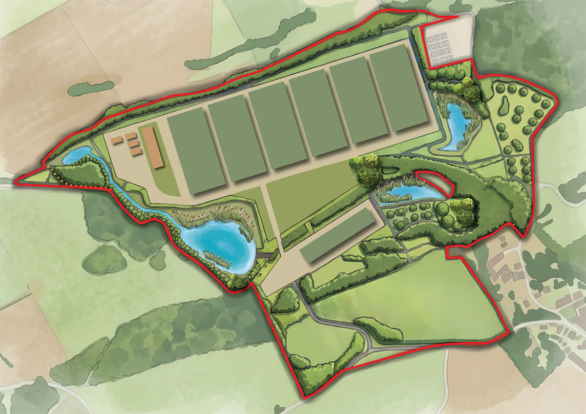
Site Layout
Cato covers around 68.6 hectares on the north-western edge of Auchtertool. Just over a third of that – 24.4 hectares – is the developed footprint. The remaining 44.2 hectares are set aside for landscape, ecology and water management.
How the site is arranged
- Closest to Auchtertool: wildflower meadow, new hedgerow planting at the site entrance, and new tree planting around the access. No buildings on the southern part of the site.
- Along the Dronachy Burn: retained and enhanced woodland, new tree planting and two SuDS features. The core path currently crossing the site will be rerouted along the burn.
- Western perimeter: a 4.7-hectare wetland designed to attenuate storm flows on the Dronachy Burn, with semi-mature tree planting.
- Northern zone (furthest from Auchtertool): the six data halls, substation, ancillary buildings, security lodge, parking and access.
- Main site access is a new entrance on the B925. An emergency access will be constructed on Fonthill Avenue / Tulloch Road.
- The site itself falls from around 134m above sea level in the southwest to 88m at its eastern edge - a drop of nearly 50m across the site. The ridge that runs east–west across the site is what screens the data halls from most of Auchtertool.
- Final building dimensions and materials would be determined as part of any detailed planning application.